![](/images/other/stat-length.png)
![Excursión Bici de montaña La Bastide-d'Engras - Chapelle St-Jean - La Bastide d'Engras - Photo](https://media.geolcdn.com/t/1900/400/ext.pjpeg?maxdim=2&url=https%3A%2F%2Fservices.sitytrail.com%2FGeolivesWS%2FDownloadMedia.ashx%3FTrailID%3D317461%26Media%3D16692_6.jpg)
Chapelle St-Jean - La Bastide d'Engras
tracegps
Usuario
![Longitud](/images/other/stat-length.png)
![Altitud máxima](https://static1.geolcdn.com/siteimages/upload/files/1508320355ic_sort_altitude_max_24dp.png)
![Desnivel positivo](https://static1.geolcdn.com/siteimages/upload/files/1508320355ic_sort_den_pos_24dp.png)
![Km-Effort](/images/other/stat-length.png)
![Altitud mínima](https://static1.geolcdn.com/siteimages/upload/files/1508320355ic_sort_altitude_min_24dp.png)
![Desnivel negativo](https://static1.geolcdn.com/siteimages/upload/files/1508320355ic_sort_den_neg_24dp.png)
![Boucle](https://static1.geolcdn.com/siteimages/upload/files/16400158638029165_repeat_loop_refresh_sync_direction_icon.png)
![Bici de montaña](https://static1.geolcdn.com/sitytour/trail-icons/202.png)
2h00
Dificultad : Medio
![Escanee este código QR para abrir la excursión en la aplicación SityTrail](https://capi.geolives.com/qq0zvz2zws4bq2lad0pu/sitytour/trails/317461/qr.png?size=200)
Aplicación GPS de excursión GRATIS
A propósito
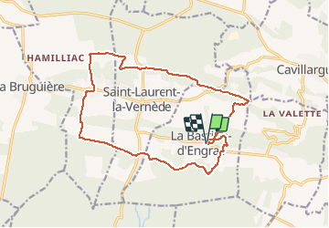
Ruta Bici de montaña de 17,6 km a descubrir en Occitania, Gard, La Bastide-d'Engras. Esta ruta ha sido propuesta por tracegps.
Descripción
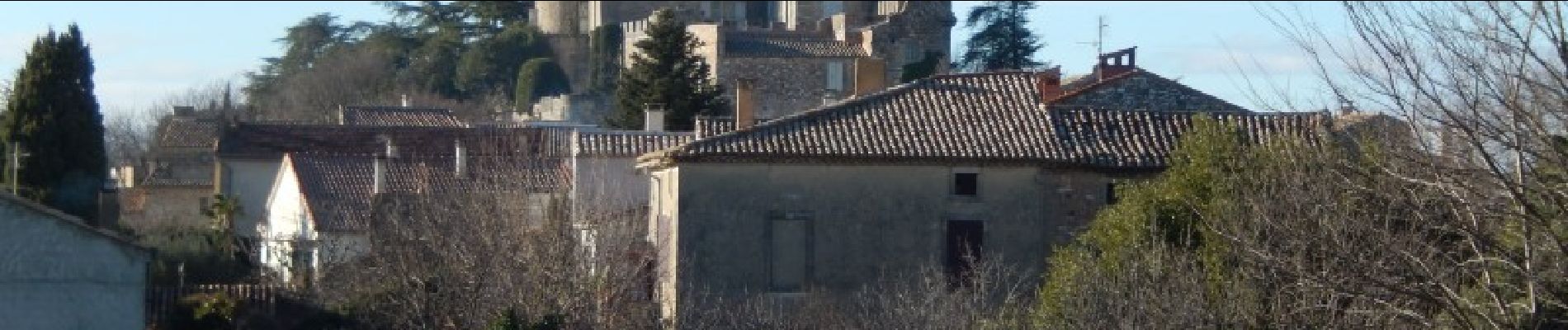
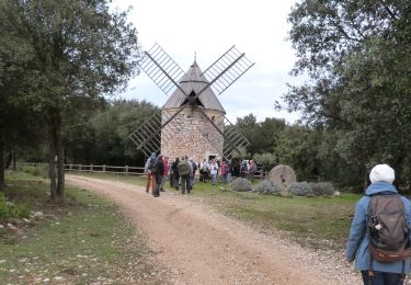
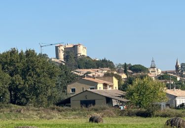
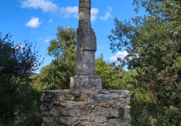
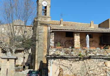
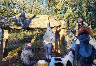
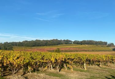
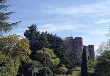
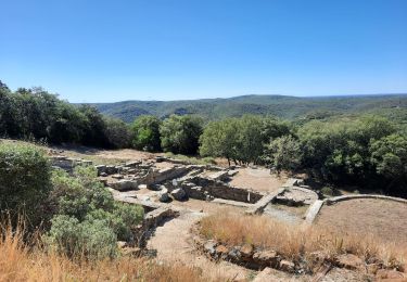
Circuit traversant différents types de sol, avec des végétations différentes dans un paysage ouvert. Stationnement à l'aire de jeux. Aller visiter la Chapelle St Jean, et partir au sud, puis à l'est pour gagner le Mas des Roches. Après un cheminement en bordure de forêt, arriver au Mas Tallen et direction nord vers le village de Fontarèche où vous trouverez un très beau lavoir. Visiter le village puis aller au nord pour rejoindre une ancienne voie ferrée, la suivre à l'est et la quitter pour la crête au sud. Paysages d'ocres et de gneiss avant de retourner au parking. Belle rando.
Localización
Comentarios
Excursiones cerca
![Senderismo Senderismo](https://static1.geolcdn.com/sitytour/trail-icons/101.png)
Senderismo
![](/images/other/stat-length.png)
![](https://static1.geolcdn.com/siteimages/upload/files/16400158638029165_repeat_loop_refresh_sync_direction_icon.png)
![Excursión sport La Bastide-d'Engras - La Bastide D’Englas Pougnadoresse - Photo](https://media.geolcdn.com/t/375/260/525a958c-f25c-4509-af30-5d5800205bf7.jpg&format=jpg&maxdim=2)
sport
![](/images/other/stat-length.png)
![](https://static1.geolcdn.com/siteimages/upload/files/16400158638029165_repeat_loop_refresh_sync_direction_icon.png)
![Excursión Senderismo La Bastide-d'Engras - 2 monastère solan avf - Photo](https://media.geolcdn.com/t/375/260/ext.jpg?maxdim=2&url=https%3A%2F%2Fstatic1.geolcdn.com%2Fsiteimages%2Fupload%2Ffiles%2F1553511878bg_sport_marche.png)
![Senderismo Senderismo](https://static1.geolcdn.com/sitytour/trail-icons/101.png)
Senderismo
![](/images/other/stat-length.png)
![](https://static1.geolcdn.com/siteimages/upload/files/16400158638029165_repeat_loop_refresh_sync_direction_icon.png)
![Excursión Senderismo Vallabrix - Vallabrix et le site de Massargues - Photo](https://media.geolcdn.com/t/375/260/ff902763-85a4-40b5-a227-c8bed2aa1b7a.jpg&format=jpg&maxdim=2)
![Senderismo Senderismo](https://static1.geolcdn.com/sitytour/trail-icons/101.png)
Senderismo
![](/images/other/stat-length.png)
![](https://static1.geolcdn.com/siteimages/upload/files/16400158638029165_repeat_loop_refresh_sync_direction_icon.png)
![Excursión Senderismo La Capelle-et-Masmolène - La Capelle-et-Masmolène - Photo](https://media.geolcdn.com/t/375/260/f4bee39f-4c39-4cab-8a93-6bf86aad1227.jpg&format=jpg&maxdim=2)
![Senderismo Senderismo](https://static1.geolcdn.com/sitytour/trail-icons/101.png)
Senderismo
![](/images/other/stat-length.png)
![](https://static1.geolcdn.com/siteimages/upload/files/16400158638029165_repeat_loop_refresh_sync_direction_icon.png)
![Excursión Senderismo Saint-Laurent-la-Vernède - 231224_St laurent - Photo](https://media.geolcdn.com/t/375/260/24a5a9aa-46b6-4b36-acdb-9e74f63400f5.jpg&format=jpg&maxdim=2)
![Senderismo Senderismo](https://static1.geolcdn.com/sitytour/trail-icons/101.png)
Senderismo
![](/images/other/stat-length.png)
![](https://static1.geolcdn.com/siteimages/upload/files/16400158638029165_repeat_loop_refresh_sync_direction_icon.png)
![Excursión Senderismo Cavillargues - Cavillargues - Photo](https://media.geolcdn.com/t/375/260/1eae67ae-d60b-425d-a7be-4c4186ef151e.jpg&format=jpg&maxdim=2)
![Senderismo Senderismo](https://static1.geolcdn.com/sitytour/trail-icons/101.png)
Senderismo
![](/images/other/stat-length.png)
![](https://static1.geolcdn.com/siteimages/upload/files/16400158638029165_repeat_loop_refresh_sync_direction_icon.png)
![Excursión Senderismo La Capelle-et-Masmolène - la Capelle Masmolène - Photo](https://media.geolcdn.com/t/375/260/bef0fd11-cf52-40d2-a314-8a457cce1486.jpg&format=jpg&maxdim=2)
![Senderismo Senderismo](https://static1.geolcdn.com/sitytour/trail-icons/101.png)
Senderismo
![](/images/other/stat-length.png)
![](https://static1.geolcdn.com/siteimages/upload/files/16400158638029165_repeat_loop_refresh_sync_direction_icon.png)
![Excursión Senderismo Le Pin - Le pin , la Garbie et oppidum - Photo](https://media.geolcdn.com/t/375/260/bb6366ab-aa65-4651-914b-693e136f7f84.jpg&format=jpg&maxdim=2)
![Senderismo Senderismo](https://static1.geolcdn.com/sitytour/trail-icons/101.png)
Senderismo
![](/images/other/stat-length.png)
![](https://static1.geolcdn.com/siteimages/upload/files/16400158638029165_repeat_loop_refresh_sync_direction_icon.png)